
Canarsie Pier, Brooklyn, New York
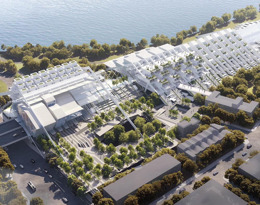
As coastal cities confront accelerating sea-level rise, City on the Loop proposes a radical rethinking of the relationship between architecture, infrastructure, and water. Set along Brooklyn’s Canarsie Pier, the project reimagines the Belt Parkway waterfront as a phased, flood-adaptive urban loop—one that transforms a hard infrastructural edge into a living, evolving shoreline.
Rather than treating climate resilience as a defensive measure, the project positions it as a generative architectural strategy. The loop functions simultaneously as housing, transit infrastructure, and public space, offering a new model for coastal urbanism that grows with environmental change rather than resisting it.
A Phased Urban System
The proposal unfolds across three temporal phases, each aligned with projected sea-level rise scenarios derived from FEMA 100-year flood data for 2025, 2050, 2100, and beyond.
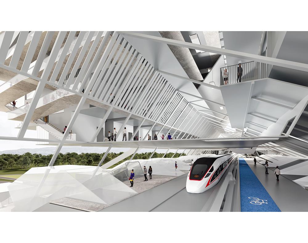
Phase One retrofits the Belt Parkway—long a physical and psychological barrier between neighborhood and water—by inserting an elevated housing and transit spine above the roadway. This move reclaims the infrastructure as a connective civic armature while establishing a resilient datum above future flood levels.
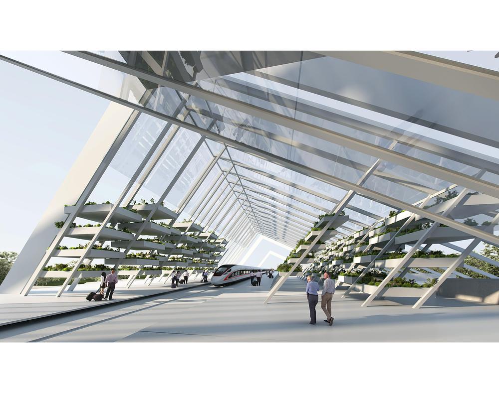
Phase Two extends the loop with additional residential density, light rail infrastructure, and water-based transit, reinforcing the system’s role as both a mobility corridor and a continuous urban edge.
Phase Three activates the waterfront with a hotel and commercial district, introducing new public destinations while drawing attention to long-term coastal conditions. Here, architecture becomes an interface for awareness, occupation, and adaptation rather than a static object at the water’s edge.
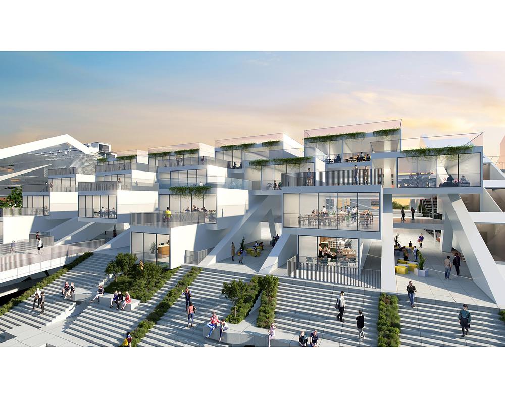
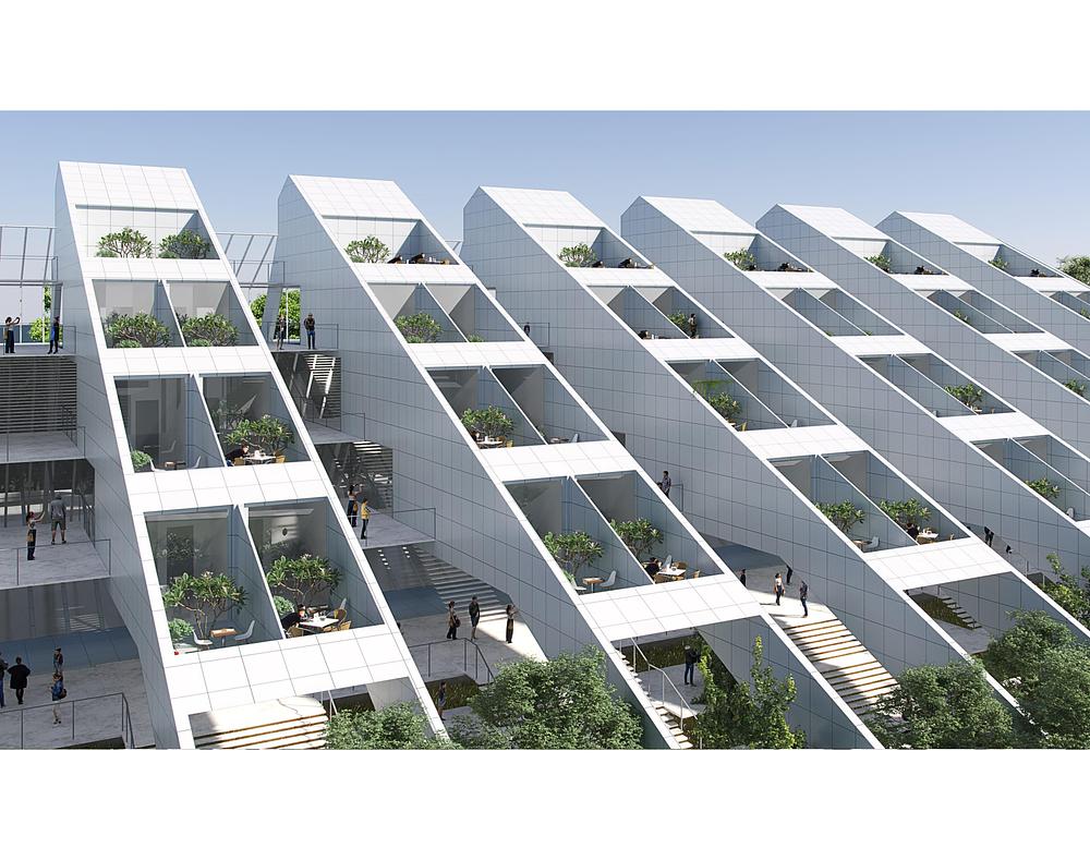
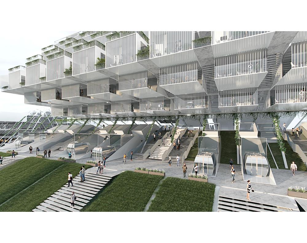
Across all phases, the structure grows vertically over time, incorporating green roofs, terraced landscapes, and elevated pedestrian networks that respond to rising water levels while expanding public access to the shoreline.
Living With Water
At its core, City on the Loop rejects the paradigm of singular flood barriers. Instead, it imagines infrastructure as a system of cohabitation—one in which wetland buffers, elevated gardens, and public platforms allow natural and urban ecologies to overlap. The loop operates not as a wall, but as a flexible, continuous, and inhabited threshold between land and sea.
“We wanted to treat sea-level rise not just as a threat, but as a prompt to reimagine how we live, move, and relate to the coast,” says designer Ruxuan Zheng. “Architecture can act as a mediator between land, water, and people—adapting over time rather than remaining fixed.”
Toward a Future Shoreline
Though speculative, City on the Loop engages deeply practical questions of housing, transportation, and environmental risk. It demonstrates how long-term thinking and architectural imagination can converge to propose new spatial identities for coastal cities.
Rather than a singular solution, the project is conceived as a replicable system—one capable of extending along the Belt Parkway to form a new urban shoreline for New York, and potentially for other vulnerable coastal regions worldwide. In this sense, the loop is less a finished form than an evolving framework: a city edge designed for uncertainty, growth, and change.
Photography / Renderings
Ruxuan Zheng
Haoyuan Wang